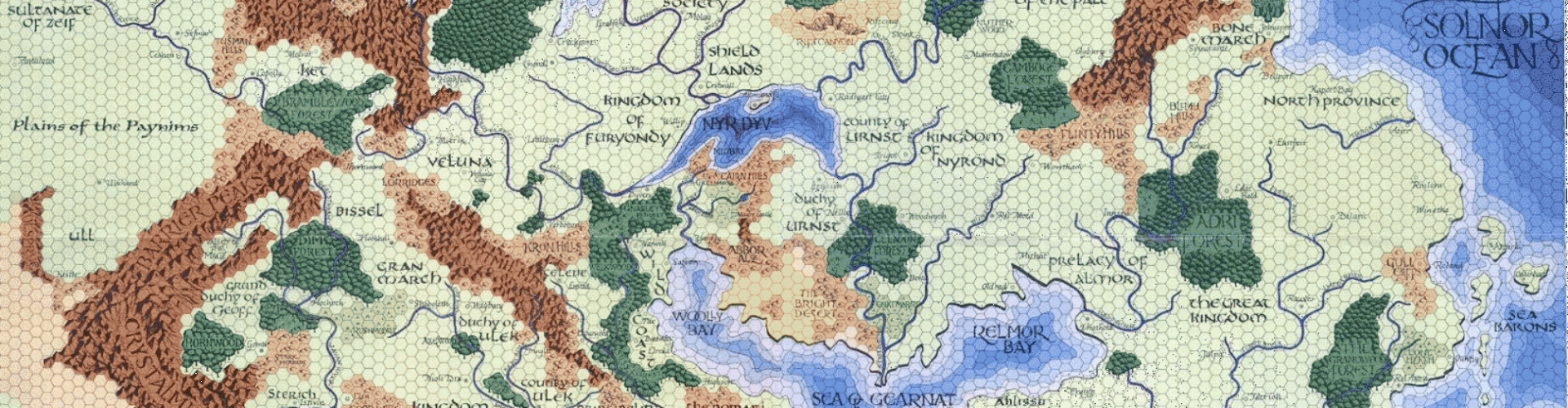
The circuit of western Oerik is almost complete. My latest map covers the southwestern corner of the great continent; Ishtarland, half of the Barbarian Seameast, and the Red Kingdom. I’ve also made major revisions to the Drazen’s Horde map (the one in the upper-right position, below), based on feedback regarding placement of some of the lands from the Chroniques de la Lune Noire. The Red Kingdom has a unique sort of terrain, to indicate the extent of the red rocks and sand that give the place its name; I don’t feel like I’m straying too far from the original feel of the Darlene maps in this, given that the Bright Desert was also a unique terrain type.
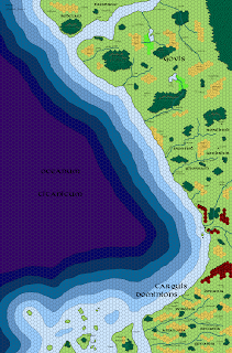
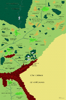
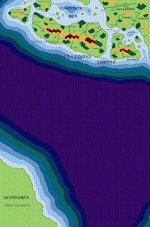
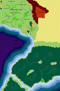
The newest map is the one in the lower-right below; I’m including some of the surrounding maps so you can see how they all fit together (click to embiggen):


As always, links to the largest-scale files are off to the right in the “free resources” section. Four maps to go; next up is the rest of the Barbarian Seameast and the southern half of the Blazing Desert, whence came the humanoids of Drazen’s Horde. Then finishing off the desert south of Erypt, two maps of Hepmonaland, and this baby is done!
Then I can get on with the gazetteers. 😉


This is so cool. You deserve a medal!
Any chance you plan to re-do the Darlene maps? I'd love to have all the maps together in one consistent style. And it'd be great to have the Darlene maps in a high quality electronic format.
Skullord: That's an idea I've thought about, but honestly I'm reticent to do it for two reasons.
First, I feel it would be intensely disrespectful of Darlene's original work. This project is intended, on one level, as an homage to her artistry. I would feel very uncomfortable if my work was seen supplanting it.
Second, creating new maps is much easier on several levels than re-creating already existing maps hex-by-hex. The exercise would likely take months, and I would never feel that my efforts were anything close to the originals.
I should also point out that there are very high-res versions of the original Darlene maps out there. I won't link to them here for legal reasons, but the earnest searcher will find his efforts rewarded.
That's a bummer, but I understand.
Now I suppose I'll just have to try and be more earnest.