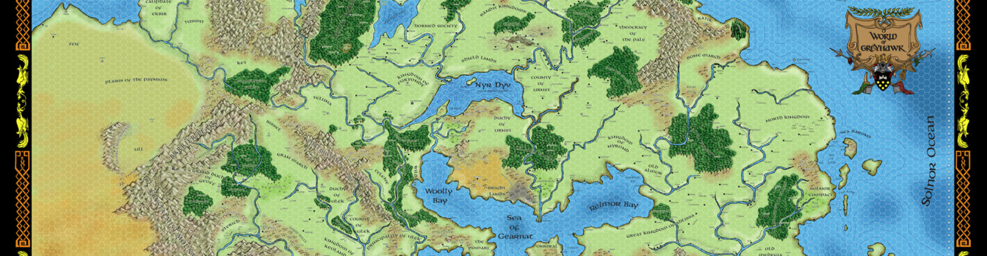


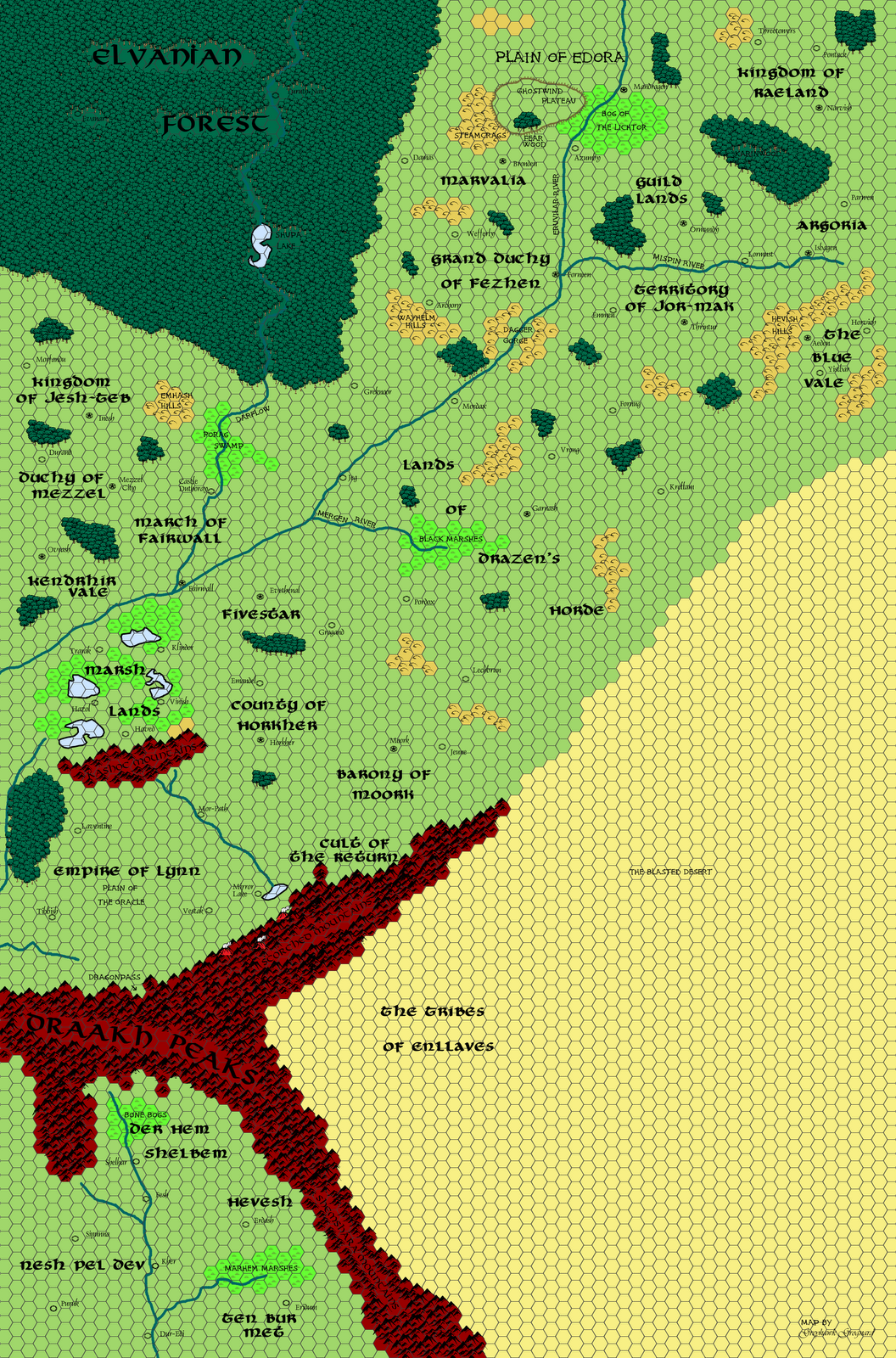
This was, in many ways, the trickiest batch of maps to do, not only because they all needed to be done together (because as you can see above, the way the grid lined up, several places such as Thalos and Lynn really need the adjoining map to give context), but also because I needed to fully integrate all three of the main sources for this region; the Sundered Empire (itself made up of several books, modules, and Dragon magazine articles), the Black Moon Chronicles region (mostly in French, but the graphic novels do give occasional snippets of geography), and the Dragon Annual #1 map. Sometimes these three sources flatly contradicted one another (as with the placement of the Empire of Lynn) or needed some slight nudging to make them work, but on the whole, I think things came out pretty neatly.
As always, click the above maps to embiggen, and the download for all the maps in largest size is off to the right in the Free Resources section. Up next; we go south again, and then back east, covering the Tharquish Empire, the rest of Ishtarland, and the Barbarian Seameast.


Seeing this side of Oerth at the standard WoG scale, is quite compelling. You must've really did your homework to make all the sources fit. Not that I know the difference, and I'm happy with that. There is alot of geographic nuances that grab me like the Flanaess and Faerun maps did back in their early days.
I can't get over how amazing these maps look and how true they are to Darlene's originals.
So, I've waited a long, long time before I ever decided to ask a question or two … I was recently doing a little thinking about the Empire of Lynn, and how the Black Moon Chronicles mesh with the original global map of Oerth. And just today, "scale" occured to me.
Granted, the BMC hadn't published a map of Froideval's setting when you did this map (I don't think), and since BMC isn't canon, there's absolutely no reason that the Empire of Lynn shouldn't have whatever national borders we decide.
That being said … How'd you decide on where to put the borders? I had a little epiphany, and realized that since the BMC is s'posed to be an alternate Earth, the BMC is about the size of Northern France, for obvious reasons. … and when I compared France to the size of the entirety of Western Oerik, I realized that it's problematic, to say the least.
Unfortunately, in the BMC, there's some nations that are definitely colder … which makes me curious if you had any ideas about the climate of canonical Lynn being more equatorial that the BMC.
I love your version of this region, and I think you did a great job.
I'm really liking the detail you have added to Drazen's Horde, Thalos and the Free States.
Thanks for pointing me at this.